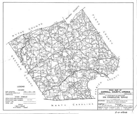
1936-1941 Aerial USDA Carroll County Maps
Please click on the map to enlarge to find the aerial photo index number.
Once you have found the identification number for the image you want, please click here to see the individual image. Please note: no close up images of sections: 1683, 1685 and 73-77. Also, no Farmer Index pages for 39-15, 39-20, 39-21, 42-72, 46-103, 73-108, 74-16, 74-39, 74-49, 74-55, 74-59, 74-104, 74-106, 89-19, 89-22, 183-48, 173-64, 173-66, 173-94, 173-107, 174-17, 174-58, 174-110, 1794... We are still looking for them.
Index list of Farm owners coming soon.....
Index list of Farm owners coming soon.....
